|
Saltford Environment Group
|
| Home | About Us | News | Website Contents & Links | Contact |

|
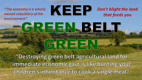
SEG Home > Green Belt (Saltford) LATEST CAMPAIGN NEWS! Read about Saltford community's request led by Saltford Parish Council for a permanent landscape designation for Saltford South lower down this page (see SEG's Green Belt Campaign). Green BeltWhat is the Green Belt?The Green Belt covers 12.4% of the land area of England and is the area around many of our towns and cities that provides the countryside next door for 30 million people. The fundamental aim of Green Belt policy is to prevent urban sprawl by keeping land permanently open. The concept of a Green Belt to protect a belt of countryside around large towns and cities originated in the 19th Century and became a reality in the 20th Century. In the 1930s a Green Belt was created around London by the city's local authorities. After WWII as the nation began to re-build its towns and cities, The Town and Country Planning Act 1947 allowed local authorities to include Green Belt proposals within their development plans. Subsequently local authorities around the country were encouraged to use formal and clearly defined Green Belts designations. Today there are 14 Green Belts in England and 1 in Wales. Saltford is surrounded by the Green Belt which is part of the "Bristol and Bath Green Belt" (aka "The Avon Green Belt"). "People deserve countryside on their doorstep where agriculture is less intensive, where there is space for nature that everyone can explore and enjoy and which is accessible to all. Green Belts have a crucial role in enhancing the sustainability of our cities. Green Belt land can provide essential ecological functions and recreational benefits which are fundamental to health and wellbeing. And this can go hand in hand with sustainable agricultural production and climate change mitigation" SEG's Green Belt Campaign
Protecting our local Green Belt is a fast moving issue for Saltford during 2024/25 as we lobby to protect our Green Belt from development in the BaNES Local Plan. You are advised to regularly visit the news section on our home page and if you are on facebook follow Saltford Environment Group there to see how the campaign develops and for information on what residents can do to help protect pur local countryside. SEG asks BaNES to comply with Government policy on the Green Belt! (Local Plan consultation response)March 2024 You can read the full text of SEG's response by clicking on this link (pdf opens in new window) :- The consultation period ends at 5pm on 16th April (deadline was 8th April but then extended after technical issues with online responses were resolved). See next item forSEG's guide on how to make an effective response concerning the south and west Saltford options. Objection reasons for 1,300 new houses in Saltford's Green Belt! February/March 2024
SEG's guide on how residents can make an effective response to the two Saltford options in the BaNES Local Plan Options Consultation is now available here on our website. If the two Saltford options are put into the new Local Plan for 2022-2042, they would add 1,300 houses and a new school on our Green Belt. The options under consideration are Saltford West (500 houses) adjacent to Grange Road and South Saltford (800 houses) adjacent to Montague Road, Manor Road. A new primary school would accompany either or both options. You can download the 2-page SEG guide here:- PLEASE NOTE : When submitting your online response you may need to 'click' on the submit button TWICE for each section response before the system accepts your response and issues a unique reference no. for your response. After clicking the first time you are advised to wait and see what happens (the page should 'refresh' itself and show your unique reference no. at the end of the page). Furthermore, if you don't receive a confirmation email from BaNES, that may mean it has not logged your response and you will need to submit it again(!). Printed copies of the SEG guide are also available from the Saltford Community Library & Post Office. The guide has been endorsed by our BaNES Saltford Ward Councillors, Cllr Duncan Hounsell and Cllr Alison Streatfeild-James. This is your opportunity to help defend the Green Belt from inappropriate development. Remember, responses need to be based on planning reasons for them to have an effect. SEG's guide is to help you do that. PERMANENT LANDSCAPE DESIGNATION FOR (i) SALTFORD SOUTH & (ii) SALTFORD'S GREEN BELT
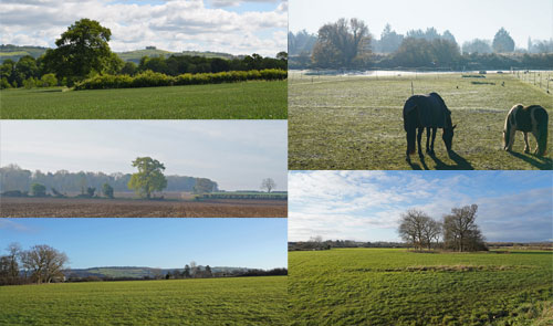
SEG's current priority is to support the request to B&NES Council on behalf of the local community made by Saltford Parish Council on 4th January 2023 for a landscape designation for Saltford South, that is the Green Belt area of Saltford that lies south of the Bath Road A4. This would be for either an AGLV (Area of Great Landscape Value), NE2a "Landscape Setting of Settlements" (i.e. a BaNES Placemaking Plan 2017 designation) or LGS (Local Green Space) designation (or a mix of two of those designations) and is officially requested from the Local Planning Authority, B&NES Council, via the B&NES Local Plan (2022-2042) consultation process. That process is likely to be completed in 2025. Saltford Parish Council agreed at its 6th February 2024 meeting to submit a response to B&NES Council that it had, in effect, dismissed the request without a formal criteria and decision-making process within BaNES Council for reaching that decision. There was no formal process for Parish Councils to apply for a landscape designation in the Local Plan process where a community places great value on the natural, historic and environmental attributes of a local landscape, despite the requirements of the NPPF (version December 2023, paragraph 180) that planning policies and decisions should contribute to and enhance the natural and local environment including protecting and enhancing valued landscapes. SPC also said that in the absence of that formal application process, SPC would have appreciated greater consideration of its detailed application, submitted in January 2023 and reaffirmed in January 2024, and the opportunity to discuss it properly. In view of BaNES Council's disappointing attitude towards protecting important landscapes, SPC said it would consider whether to expand the original request whilst considering other means of achieving protection in the absence of support from our Local Planning Authority. SPC said it obviously reserved the right to appeal to the Secretary of State. It was also resolved at SPC's 6th February 2024 meeting to urgently seek the support of Sir Jacob Rees-Mogg MP regarding the Parish Council's request for landscape designation at 'Saltford South'. SPC has since requested a meeting with Sir Jacob and members of its Local Plan Working Group. The Working Group's members are Cllr Phil Harding (Planning Chair), Cllr Jon Godfrey (SPC Chair), Cllr David Halton (Vice Chair), and Cllr Gary Graveling. Saltford's Green Belt is an Area of Great Landscape Value, says SPC At Saltford Parish Council's meeting on 5th March 2024, SPC resolved to adopt as a planning policy document its new paper "The Saltford Area of Great Landscape Value - Planning Policy and Character Appraisal by Saltford Parish Council". SPC agreed that this new Saltford Area of Great Landscape Value paper would serve as a reference document for SPC planning policy purposes, specifically in relation to future proposals that may affect or seek to develop Saltford's Green Belt landscape area. Saltford Parish Council, in describing Saltford's landscape setting as an Area of Great Landscape Value, seeks to provide information and data that offers planners and developers a greater insight of this landscape's high quality and value to the community. SPC makes the point in its paper that the support and recognition of Saltford's Local Planning Authority, BaNES Council, for a landscape designation, through either an AGLV or NE2a (Landscape Setting of Settlements) designation, would provide reassurance to the community of Saltford and neighbouring parishes that the Local Planning Authority values this landscape as much as the community it seeks to represent and will protect it from development. As resolved at its 5th March 2024 meeting, SPC also sent the paper to BaNES Council as supporting evidence for its response to the BaNES Local Plan Options Consultation. ENDORSEMENTS The community's great value that it puts on the local landscape both for the health and wellbeing of the community and for the important habitat it provides for wildlife, is demonstrated by the endorsement of the paper by Saltford Community Association, St Mary's Parochial Church Council and Saltford Environment Group. Furthermore, the Avon & Bristol Branch of the CPRE (Campaign for the Preservation of Rural England) has endorsed the paper too. In confirming the CPRE's endorsement the Area Director said that "this is a comprehensive and rigorous report. In the context of the ecological and climate emergency declared by BaNES, a community led approach to character appraisal such as this should be applauded. ...CPRE local area branch endorses the aims and objectives of the document and the importance of protecting from development Saltford's Green Belt landscape surrounding the village." PHOTOGRAPHIC RECORD As a stand alone document but also to complement the "The Saltford Area of Great Landscape Value" paper, at its 5th March meeting SPC also resolved to adopt as a SPC document "Saltford's Area of Great Landscape Value - A Photographic Record". The collection of photographs it contains provides a snapshot and will become a historical record of the rural countryside setting that the Green Belt surrounding Saltford's housing boundary provides at the present time. SEE THE NEW DOCUMENTS You can download the documents below from these links:-
As these documents are of significant importance to the community whilst forming a historical record, SEG has archived and made available copies of both papers in SEG's History of Saltford Project - Document Library. The original landscape designation request documents for Saltford South can be found in the BACKGROUND INFORMATION section of this news item below. FURTHER INFORMATION Further information about these important new documents can be found on SPC's website from this link >> BACKGROUND INFORMATION Landscape Designation Request for Saltford South NOTE. SEG'S KEY OBJECTIVE Protecting Saltford's Green Belt from development is a key objective of SEG. SEG therefore maintains pre-prepared documentation setting out the planning case for why the Green Belt and other relevant policies of the National Planning Policy Framework (NPPF), prove why, in national and local planning policy terms, Saltford's Green Belt is not appropriate for new housing or mixed-use developments. SEG does not deny that new homes are required and especially affordable homes for an unmanaged growing population, but they must be built in appropriate locations and represent genuine sustainable development. The annual reports from the CPRE on the state of brown field land in England reveal that this previously developed land could accommodate well over 1 million new homes and a significant number on the West of England's brownfield sites. Key news of activities associated with SEG's continuous campaign to protect Saltford's Green Belt from development can be found on this page. Campaign news will feature regularly on our home page. As a reference source we have published at the end of this page in our Campaign Archive some of SEG's written evidence, articles and other lobbying material etc. from our campaign. See also our special Green Belt Inquiry (2013) Archive Page. Saltford's Green BeltThe housing development area of Saltford is surrounded by Green Belt and the Cotswold Area of Outstanding Natural Beauty (AONB) on the eastern bank (Bath side) of the River Avon towards Kelston and the Round Hill. Saltford is also surrounded by the Community Forest of Avon area (N, W and S sides of the village). The Parish Plan (2010) describes the local purpose and views about our Green Belt as follows: "Saltford lies within the Bristol/Bath Green Belt which is how it has managed to keep its countryside setting, and there is a clear view amongst residents that this Green Belt surrounding the village should continue to be protected from erosion through housing development." 93% of respondents to the Parish Plan questionnaire circulated in September 2009 thought it was important to preserve the Green Belt around Saltford. This demonstrates that a key reason why people choose to live in Saltford is for the quality of the local natural environment and countryside. The habitat it provides for local wildlife is also important and highly valued by residents. If we wish Saltford to retain the character and size of a rural village (Saltford is classified as a Rural Area RA1 village in the B&NES Placemaking Plan 2017, i.e. development will be acceptable within and adjoining the housing development boundary on land outside the Green Belt), then the protection of the Green Belt surrounding the village from development is essential. Against the background of a rising population, climate change and an ecological emergency it is also increasingly important that, for the ability of the local area to produce food for current and future generations, we protect viable agricultural land and natural/semi-natural land within the Green Belt. Farmland requires the ecosystem support (e.g. habitat for pollinating insects) of surrounding Green Belt and natural/semi-natural land to function. The Green Belt has a valuable role in providing food and habitat for our wildlife and thus protecting the biodiversity that is so important for a healthy environment that in turn is essential for our quality of life whether we live in Saltford itself or in neighbouring towns and cities where recreational access to the countryside is equally important. Photography & Advice for Drone Operators
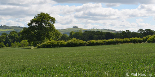
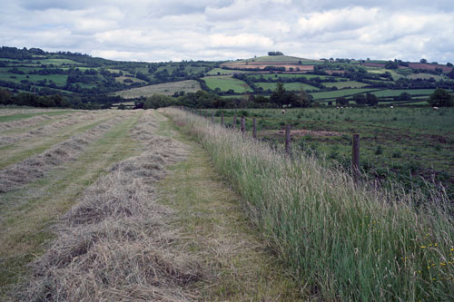
Saltford's attractive Green Belt landscape with its Cotswold AONB backdrop including Kelston Roundhill and the River Avon, itself an SNCI (Site of Nature Conservation Interest), unsurprisingly attracts photographers during all seasons of the year. If you want to see some of the work of photographers based in and around Saltford, see the Saltford Photographers group on facebook: #saltfordphotographers. Drone operators wishing to take aerial video or photographs of or near Saltford need to be aware that Saltford Airfield has 3km and 5km flight restriction zones that cover much of Saltford. A drone should never fly in an airport or airfield's restriction zone without prior permission and drone operators are responsible for ensuring they comply with the latest safety regulations issued by the Civil Aviation Authority (CAA). The operator of Saltford Airfield has produced a helpful 3-page pdf guide for drone operators that also includes CAA advice and this can be downloaded from SEG's website from this link:- Enquiries about flying drones should be made to Saltford Airfield (contact details are in the above guide). Local PlanThe Local Plan (or Development Plan) in Bath & North East Somerset primarily comprises the Core Strategy (adopted in 2014) and the Placemaking Plan (adopted in 2017), both of which cover a plan period up to 2029. B&NES Council is required to review the Local Plan every five years in order to determine whether it remains fit for purpose or whether all or part of it needs to be updated. Important landscape designation for Saltford South to be sought by SPCJanuary 2023
At its meeting on 3rd January, Saltford Parish Council resolved by unanimous vote to seek a landscape designation for Saltford South, that is the Green Belt area of Saltford that lies south of the Bath Road A4. This would be for either an AGLV (Area of Great Landscape Value) or LGS (Local Green Space) designation (or both) and would be officially sought from the Local Planning Authority, B&NES Council, via the B&NES Local Plan (2022-2042) consultation process. To read the case discussed and approved at the SPC meeting click on the links below (pdf files open in new window) :- The formal request was submitted by SPC to B&NES Council on 4th January 2023. SEG fully supports this approach and the case made for securing Saltford's valuable landscape for nature and for existing and future generations. Local landscapes belong to local communities - they are an intrinsic part of their heritage and the reason why they live where they do. Local Planning Authorities have a duty to respond positively to the wishes of communities that value their local green spaces, especially at a time of heightened concerns about the ecological and climate emergencies. For more information about this on SPC's website click on this link:- SPC - Saltford South >> COPYRIGHT NOTE Permission to reproduce or publish photographs in the case paper and/or its annex including requests for high resolution versions should be sought directly from Phil Harding via email at phil@philharding.net. SPC's new evidence for Local Plan Partial Update's Public ExaminationMay 2022 The B&NES Local Plan Partial Update (LPPU), as submitted to the Secretary of State on 17th December 2021, will be examined for its compliance with statutory requirements and on its soundness by an independent Inspector appointed by the Planning Inspectorate at a Public Examination starting on 21 June. The Inspector will only consider written representations to the Public Examination that contain new evidence to representations already submitted to B&NES Council when B&NES Council consulted on the draft LPPU in 2021 (and will be available to the Inspector). SEG, through its close and direct relationship with Saltford Parish Council Councillors, fully supports the new evidence submitted by SPC to the Public Examination. Latest news on the Local Plan Partial Update features regularly on our home page. SPC and SEG respond to B&NES Local Plan Partial Update consultationOctober 2021
On 5th October 2021 Saltford Parish Council agreed its response to B&NES Council on the draft Local Plan Partial Update (LPPU) - this update is being made by B&NES Council to take account of the climate and ecological emergencies before a full review of the Local Plan alongside the West of England Combined Authority Spatial Development Strategy (SDS) in 2023. The proposed update from B&NES does not threaten Saltford's Green Belt with development but an additional 280 houses are proposed for the safeguarded former Green Belt land on the east (Saltford) side of Keynsham. It is hard to find anyone who seriously considers this to be a sound way to meet new housing needs. SPC's response to B&NES, which SEG fully endorsed as a consultee in its own consultation response on 6th October 2021 to B&NES Council, contains several key points that reflect a shared view on protecting the Green Belt, restoring ecology and supporting sustainable transport. You can download the full text of SPC's response here:- SPC LPPU response 5.10.2021 (pdf opens in new window). SEG supports the Green Belt in B&NES Local Plan Partial Update consultation responseFebruary 2021
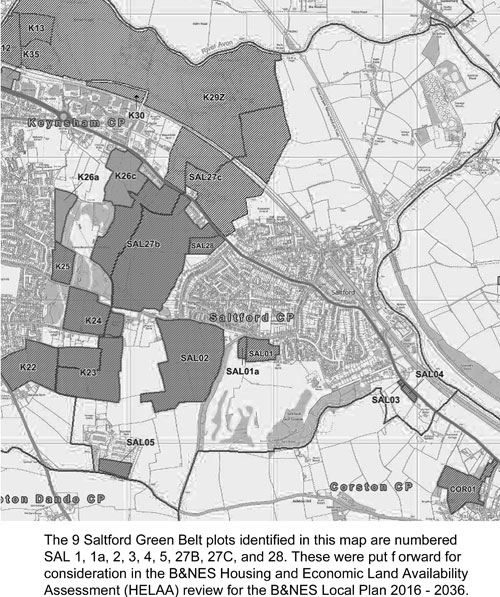
A full review of the B&NES Local Plan will be undertaken alongside the WECA Spatial Development Strategy (SDS) which is scheduled for publication in 2023. In the interim B&NES is undertaking a Partial Update of the Local Plan to address a number of urgent issues, e.g. a climate emergency and an ecological emergency has been declared by B&NES. SEG submitted detailed comments to B&NES Council on its Local Plan Partial Update (LPPU) consultation on 4th February 2021. SEG's response was similar to the Saltford Parish Council response agreed at its February meeting. The consultation ends on 18th February and more information can be found from this external link. In addition to commenting on a proposals concerning infill boundaries for Green Belt villages, SEG submitted comments on the proposals for further development of land at north and east Keynsham. SEG agreed with SPC that this area is at risk of over-development taking account of the demands on transport and other services and the loss of green spaces around and within Keynsham as a whole arising from the recent developments authorised by the Core Strategy/Local Plan. In its response SEG reminded B&NES Council that if the two safeguarded sites at east Keynsham are to be developed, such development should be in response to genuine need, not demand, for new housing that cannot be satisfied from use of vacant buildings (e.g., the repurposing of retail and offices) and underused previously developed land outside the Green Belt, i.e. in accordance with planning policy announcements in 2020 from B&NES Council, the West of England Combined Authority (WECA) and the Ministry of Housing Communities & Local Government. SEG also submitted comments on the Housing & Economic Land Availability Assessment (HELAA) 2021 update for Saltford and referred to the planning reasons for not developing the 9 Saltford sites in Saltford's Green Belt that were assessed in 2018 for the 2019 HELAA (see map below) that all still remain valid.
Finally, SEG referred to B&NES Council's obligation and responsibility to protect the Green Belt for the potential eco-system support for nature and biodiversity it can provide helping to underpin food production and food security, whilst open green space has recreational and quality of life value for local communities, a value heightened by the COVID-19 pandemic. Taking those factors into account, the combined environmental, societal and economic value of the Green Belt far outweighs any short-term economic gain from its development, development that would be contrary to sustainable development principles and the National Planning Policy Framework (NPPF). The text of SEG's full response can be viewed here:-
OLDER LOCAL PLAN NEWS ITEMS (for reference) SEG submits its response to B&NES Local Plan OptionsDecember 2018
On 11th December 2018 SEG submitted to B&NES Council its response to the B&NES Local Plan Options consultation. We have reported previously concerning the similar response on 4th December from Saltford Parish Council produced jointly with SEG - that can be seen at the end of this news item. Key points in SEG's detailed response included the following:-
A website version of SEG's response can be downloaded here: SEG LP Options response 11.12.2018 (pdf opens in new window). The Saltford Parish Council agreed response can be downloaded here: SPC LP Options response 4.12.2018 (pdf opens in new window).
The map above shows all 9 of the Saltford Housing and Economic Land Availability Assessment (HELAA) sites that were considered/assessed in order to inform preparation of the B&NES Local Plan Options for development. Those 9 site are all on Saltford's Green Belt and were submitted to B&NES by developers/land owners following a call for sites in early 2017. Our campaign's objective is to make sure those sites stay out of the Local Plan, as they are unsuitable on planning and sustainable development grounds for development, and to protect from development the Green Belt surrounding Saltford. You can download SEG's HELAA response in November 2017 here:-
A larger version of the above map together with a short briefing note on the B&NES Local Plan and West of England Joint Spatial Plan process that was discussed at our 8th October AGM can be downloaded from the link below. Please note that the dates within the note are all subject to change. Green Belt briefing for 08.10.2018 AGM (pdf) The dedicated B&NES Local Plan web page can be found from this link: B&NES Local Planning Policy. HELAA: SEG makes case to B&NES that our Green Belt is not appropriate for developmentJanuary 2018
B&NES Council is carrying out a Housing and Economic Land Availability Assessment (HELAA) review and SEG submitted its response to the B&NES report on 9th November 2017. HELAA is required in order to identify and assess land that could be considered for allocation in the Local Plan (previously known as the Core Strategy Review) that will cover the period 2016-2036. The primary purpose of the Local Plan 2016-2036 is to identify and allocate sites to meet the housing and economic development requirements established by the West of England Joint Spatial Plan (JSP). The council undertook a call for sites (CFS) between January and March 2017 requesting land to be identified and submitted to the council for assessment through the HELAA process. Anyone could submit land for consideration, but part of the assessment relates to the availability of the land and therefore land normally needs to be owned by someone who is willing to develop it or to sell the land to a third party who is willing to do so. Apart from availability, it was stated that the assessment would consider both the suitability and the achievability of land. As SEG predicted, developers have identified Green Belt land on the south and west side of Saltford that they would like to build on. SEG and the Parish Council have responded accordingly, SEG on 9th November, and both responses were strongly against such development for a range of planning and sustainable development reasons including traffic congestion, new developments should be close to the sources of employment to reduce the need to travel for commuting and that it is unsustainable to build on the Green Belt which would be contrary also to national planning policy (known as NPPF). Furthermore at the public meeting held at Saltford Golf Club on 1 December 2016 the Leader of B&NES Council, Tim Warren, said that the "current B&NES administration had no intention to allow housing development on Saltford's Green Belt in the Joint Spatial Plan". On 9th January 2018 SEG submitted its response to B&NES to the B&NES Local Plan 2016-2036 Issues & Options document. SEG said it supported and was in full agreement with the response from Saltford Parish Council that was agreed by the full Parish Council on 2 January 2018. The response underlined and gave reasons for protecting the Green Belt and raised concerns over transport issues and stated that it was essential that appropriate and necessary transport infrastructure changes are made to reduce vehicles use on the A4 before any additional housing is planned for the area that would in effect place more vehicles on the A4 through Saltford or on other pinch points on the A4 route between Bristol and Bath. In addition to comments on affordable housing, the protection of archaeological sites and the importance of the rural villages close to Bath, SEG added a further explanation behind why the Green Belt needs protection as follows:- 81% of B&NES is farmland compared to the national average of 57% yet only 5% of B&NES is natural or semi-natural land (heathland, natural grassland etc.) compared to a national average of 35% (data source: Dr Alasdair Rae, University of Sheffield, using Co-ordination of Information on the Environment (Corine) land use codes, 2017). Farmland requires the ecosystem support (e.g. habitat for pollinating insects) of surrounding Green Belt and natural/semi-natural land to function. It would be irresponsible not to protect B&NES' natural/semi-natural land that underpins the economy of the B&NES and wider West of England area and our future food security in a changing climate made more critical by unmanaged population growth. Updated January 2018 Placemaking Plan(s)
1. Saltford Placemaking Plan (2013)Saltford's Placemaking Plan was produced by a Working Group appointed by Saltford Parish Council and published on the SPC website in December (2013). The community was consulted on its contents between 23 November and 6 December 2013. The purpose of this plan is to complement the strategic planning framework provided in Bath & North East Somerset Council's Core Strategy. It provides an updated and refreshed planning policy framework for managing development in the Parish of Saltford. The plan breaks Saltford down into 7 distinct character zones: Green Belt, Conservation Area, housing settlements (north and south of the A4), river Avon frontage, A4 corridor and the two large satellite sites within the Green Belt. The following extract from the Green Belt character assessment (Chapter 6) and is as relevant today as it was in 2013:- The Cotswold AONB ridge and the distinctive local landmark of Kelston Round Hill (also known as Kelston Tump) together with Saltford's Green Belt and the river Avon provides a rural setting for the village. Despite Saltford's proximity to the cities of Bath and Bristol and the neighbouring town of Keynsham, this landscape gives Saltford its own distinctive character complementing and preserving both the setting of Saltford's Conservation Area with its historical buildings and the newer housing developments within the village. The openness of Saltford's Green Belt also provides a sense of permanence to the countryside surrounding the village, provides separation whilst keeping in check urban sprawl from Keynsham, Bristol and Bath, and helps to safeguard the adjacent countryside including the Cotswold AONB from encroachment. It is also a very important green infrastructure asset for Saltford and the wider community of Bath & North East Somerset. It provides ecosystems that support agriculture and wildlife together with an element of flood protection for the village from the river Avon and from surface water flooding arising from extreme rainfall events. In addition to sports facilities offered by Saltford Golf Club and the sports ground by Saltford Hall, the Bristol and Bath Railway Path together with Saltford's extensive network of public footpaths provide the community and many visitors from neighbouring urban areas with a healthy environment much of which is considered locally to be of outstanding scenic value. This also enables leisure activities such as walking and cycling that are important for healthy lifestyles and a general sense of well-being. 93% of households that responded to the Saltford Parish Plan questionnaire in 2009 specifically said that they wanted Saltford's Green Belt to be protected. This clearly expressed view is reflected in the 2010 Saltford Parish Plan's objective to "prevent development that will encroach upon the Green Belt around Saltford". 2. B&NES Placemaking Plan (2017)The B&NES Placemaking Plan is an important document as combined with the Core Strategy (adopted in 2014) these form the B&NES Local Plan (until it is replaced with a new Local Plan in c.2025). You can view the archived B&NES Placemaking Plan that was adopted in July 2017 on the B&NES Council website from this link: B&NES Placemaking Plan web page. A road bypass for Saltford?The loss of Green Belt land from construction and the infill development that would inevitably follow, is just one of several reasons why a discussion paper produced for Saltford Environment Group's Committee says that at the present time the case has not been made for a bypass as a suitable solution for peak time traffic congestion in Saltford. The discussion paper looks at the potential adverse effects our village might face if a bypass was to be built, creating more environmental, social and economic problems than it would solve. The threat to our Green Belt and agricultural land from a bypass would be considerable as shown by the rejected proposals by B&NES Planners in January 2013 for a southern route bypass containing an infill of 5,000+ houses in the context of the draft Core Strategy. Furthermore the West of England Transport Study Final Report by Atkins (October 2017) concluded that a southern route bypass "would cross difficult terrain, with steep slopes south east of the village. It would be necessary to create a significant cut in the hillside, with a relatively steep gradient and potential requirement for a climbing lane in the westbound direction. These issues would collectively result in landscape impacts, major earthworks and relatively high scheme costs." The policy discussion paper on a road bypass for Saltford (first published 9.1.13) is a 'living document' that we shall review and update periodically. It can be downloaded here: Standing room only at the Saltford bypass public meeting (1.12.2016)
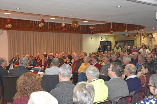
On the evening of 1st December 2016 c.200 residents attended a public meeting at Saltford Golf Club. This was arranged at short notice by Saltford Parish Council to give residents an opportunity to hear about the proposed bypass as illustrated in the West of England Joint Transport Study "Transport Vision" document which has a very short consultation period from 7th November to 19th December. On the panel stating their position on a bypass and taking questions from residents were Cllr Tim Warren, Leader of B&NES Council; Cllr Tony Clarke, B&NES Cabinet Member for Transport; Cllr Francine Haeberling, Ward Councillor for Saltford (Cons); Cllr Chris Warren, Chairman of Saltford Parish Council; and Duncan Hounsell, representing B&NES and Saltford Liberal Democrats. The meeting was chaired by independent chairman and Saltford resident, Dick Bateman. Cllrs Tim Warren and Tony Clarke were emphatic that the line on the map showing a bypass route south of Saltford was illustrative only and there were no plans for a bypass on any particular route around Saltford. It was being considered in only general terms at this stage as part of the mix of transport solutions to help alleviate the traffic congestion on the Bath-Bristol transport corridor as part of the Joint Transport Study which was intended to cover a 20 year period from 2016 to 2036. The majority of questions from the floor expressed concerns at the potential impacts on Saltford and the potential for infill housing on the Green Belt from a bypass. The need for evidence based information on the different options or solutions before the community was asked to express a firm opinion was also emphasised by several residents. A number of residents in the audience and the panel members from Saltford asked for the next published draft of the transport vision to not include any indicative line for a Saltford bypass. It was strongly felt that any indicative line showing a possible bypass would put an unnecessary long term housing and planning blight on a large part of Saltford. Food Security and the Green BeltAn estimated 75% of food crops rely on pollinators to some degree and 95% of food comes directly or indirectly from the soil...
The extreme fluctuations in our weather we experience increasingly are a symptom of human-induced climate change and can have drastic affects on food supplies and food prices. Clearly, extreme weather, fluctuating between prolonged periods of wet weather, heat waves and drought, arising from climate change makes a direct impact on the carrying capacity of the UK and can and will have a drastic effect on food supplies and food prices, i.e. food security. Rather than waiting for a food supply crisis to occur in the UK before taking action when it may be too late, the UK should plan ahead urgently by protecting our agricultural land and making sure we provide sufficient headroom to take account of population growth raising the demand for food whilst climate change induced extreme weather reduces our agricultural land's capacity to produce food. It is reasonable to accept that the UK will always have to import some food but imports are likely to become less reliable or affordable. Who feeds Saltford & B&NES?Saltford including the housing development area is approximately 5.5 km2, just over 2 square miles, or 1,400 acres. Taking account of the existing developed land within the housing development boundary (approx. 1.1 km2, or 270 acres), we have around 1,100 acres left.
If we assume approximately 1 acre of agricultural land is required to feed one person (this is affected by diet and food production methods) then Saltford's population of 4,073 (2011 census) requires 4,073 acres, i.e. a footprint some 3 times larger than Saltford and its green belt. "Keeping land permanently open" is a purpose of Green Belt. The National Planning Policy Framework (NPPF - 2023) states (para. 120) that planning policies and decisions "should recognise that undeveloped land can be used for carbon storage or food production". In 2020, 71% of the UK's land, or 17.3 million hectares, was used for agricultural production, of which 72% was grassland and 26% cropland, with the remainder being set-aside or fallow land (source gov.uk re. Defra (AUK) 2020). B&NES's role in helping to feed the UK56.7% of the UK is farmland. 81% of B&NES is farmland yet only 5% of B&NES is natural or semi-natural land (heathland, natural grassland etc.) compared to a national average of 35%*. Farmland requires the ecosystem support (e.g. habitat for pollinating insects) of surrounding Green Belt and natural/semi-natural land to function. It would be irresponsible not to protect B&NES' natural/semi-natural land that underpins the economy of the B&NES and wider West of England area and our future food security in a changing climate made increasingly more critical by unmanaged population growth. *Data source: Dr Alasdair Rae, University of Sheffield, using Co-ordination of Information on the Environment (Corine) land use codes, 2017. The UK's Food Supply: Who feeds the UK?If we consider the importance of green belt agricultural land for feeding the UK as a whole, we might question the wisdom and resilience of a proportional increase in our reliance on imported food in recent years to feed us. Is this sustainable in the face of increasing incidences of extreme weather events, due to climate change, and a rising world population? The UK's overall self-sufficiency in food during World War II increased from a historic low of about one-third at the beginning to around two-thirds by the end. The UK's highest period of self-sufficiency during the 20th century was in the 1980s (60 - 70%). The UK's self-sufficiency in food has declined since the mid 1980s. The official figure from Defra reveals the UK to have a "self-sufficiency" ratio - includes food exported that could otherwise be consumed, feed, seeds and livestock - of 60% in 2020 (source Defra Agriculture in the United Kingdom (AUK) 2020).
Based on the farm-gate value of unprocessed food in 2017, the UK supplied just under half (50%) of the food consumed in the UK. The leading foreign supplier of food consumed in the UK were countries from the EU (30%). Africa, Asia, North and South America each provided a 4% share of the food consumed in the UK. The three largest value imported commodity groups (at 2017 prices) were fruit & vegetables, meat and beverages Total UK cereal production has fluctuated, with significant dips in 2001, 2007, 2012 and 2013, linked to adverse weather conditions in those years. There was an 5% rise in 2017 compared to 2016 reflecting the above average yields recorded in 2015. Successive spikes in the price of agricultural commodities since 2007 have led to higher retail food prices. They have not returned to the low price levels of pre-2007. Low income households are affected disproportionately when food prices rise as they spend a greater proportion of their income on food. Note. Source of UK food supply data is published as National Statistics from www.gov.uk: Food Statistics Pocketbook (annual publication, Defra) RELEVANT FACTS THAT AFFECT OUR FOOD SECURITY UK population since 1901 (Source: Census etc, rounded):
UK population density (approx):
The world's population is growing by c.0.9% per annum which is c.200,000 net additions every day (2021 est.).
It took until the early 1800s for the world population to reach one billion. Now we add a billion every 12-15 years.
Agricultural land lost to land degradation (worldwide):
Climate change will depress agricultural yields by 15-50% in most countries by 2050.
*1 hectare = 2.47 acres. I acre = approx. 1 small football pitch. Links to sources of UK population and food security data/information:
Resources from SEGYou can download SEG's Food Security Information Sheet (2013) here:-
SEG's Gardenshare Document (tenancy agreement): Policies and Government statements that affect the Green BeltB&NESThe following two planning policy documents together represent the B&NES Local Plan (covering 2011-2029):-
Note (subject to change!): Work on producing a new B&NES Local Plan for the 20-year development planning period 2022 to 2042 commenced in autumn 2022 with stakeholder consultations planned for 2023 and 2024. The target for final adoption is 2025. National Government Planning Policy (NPPF)
In the NPPF (Dec, 2023) the Green Belt serves 5 purposes (Chapter 13 "Protecting Green Belt land", para. 143) :- (a) to check the unrestricted sprawl of large built-up areas; (b) to prevent neighbouring towns merging into one another; (c) to assist in safeguarding the countryside from encroachment; (d) to preserve the setting and special character of historic towns; and (e) to assist in urban regeneration, by encouraging the recycling of derelict and other urban land. The NPPF (at paragraph 180) provides the planning policy necessary for the protection and enhancement of the environment and landscapes. RECENT GOVERNMENT STATEMENTS WITH IMPLICATIONS FOR (PROTECTING) THE GREEN BELT (most recent 1st):-We have reproduced recent policy statements from Government Ministers concerning protection of the Green Belt (and related matters). 19.12.2023 New NPPF 'clarifies local lock on any changes to Green Belt boundaries'On 19th December Levelling Up, Housing and Communities Secretary Michael Gove issued a public statement "The Next Stage in Our Long Term Plan for Housing Update" announcing the second update in 2023 (3 months after the previous update in September 2023) of the National Planning Policy Framework (NPPF). These are extracts from his statement relevant to protecting the Green Belt:- In summary, the new NPPF will: facilitate flexibility for local authorities in relation to local housing need; clarify a local lock on any changes to Green Belt boundaries; safeguard local plans from densities that would be wholly out of character; free local authorities with up-to-date local plans from annual updates to their five-year housing land supply; limit the practice of housing need being exported to neighbouring authorities without mutual agreement; bolster protections from speculative development for neighbourhoods that develop their own plans; support self-build, custom-build and community-led housing; and cement the role of beauty and placemaking in the planning system. This Government is committed to protecting the Green Belt. Planning policy already includes strong protections to safeguard Green Belt for future generations. The Green Belt is vital for preventing urban sprawl and encroachment on valued countryside. England's cities are already less dense than those of most of our European neighbours. That is environmentally wasteful and economically inefficient. We seek to support the gentle densification of urban areas in preference to the erosion of Green Belt land. That is why the Government is ensuring it is clear there is generally no requirement on local authorities to review or alter Green Belt boundaries if this would be the only way to meet housing need. The full text of Secretary of State's statement can be found on the parliament.uk website from this link. 1.11.2023 New Environmental Principles Policy StatementMinisters and government departments have a new legal duty to "have due regard" to the Environmental Principles Policy Statement (EPPS) and therefore an obligation to consider the impact their policies will have on the environment that came into effect on 1st November 2023. The Office for Environmental Protection (OEP) will now scrutinise and monitor the implementation of this obligation across Government. The OEP will scrutinise and monitor the implementation of the EPPS across Government and intends to report to Parliament after the summer of 2024. The EPPS covers five environmental principles set out in law that are:-
For the purpose of this policy statement, the EPPS (and as defined in the Environment Act 2021 section 45), "environmental protection" means:-
SEG COMMENT Although this policy is aimed at central Government it is intended to guide policy decisions and policy making, and specifically "national policy statements, strategies and frameworks" (as described in the "Policy making" section of the EPPS). The Green Belt is protected by the National Planning Policy Framework (NPPF) and the implementation of planning policy requirements including policy frameworks such as the Government's NPPF, by default, is now subject to the Environmental Principles Policy Statement (EPPS) that is a "statutory document" under the Environment Act 2021. Section 17 of the Environment Act 2021 states that "The Secretary of State must be satisfied that the statement will, when it comes into effect, contribute to (a) the improvement of environmental protection, and (b) sustainable development." The EPPS is intended to influence national policies including national planning policies, and thus the interpretation of sustainable development and environmental objectives of the NPPF, and not each individual planning decision. However, planning decisions have to be made in accordance with planning policies and in particular the adopted Local Plan that in turn is a requirement of the NPPF which now has to be compliant* with the EPPS. * i.e. its interpretation with regard to the improvement of environmental protection and sustainable development. RELEVANT LINKS The Office for Environmental Protection (OEP) press release on the EPPS can be found from this link. The EPPS web page on gov.uk can be found from this link. 24.7.2023 "Long-term plan" for housing - Government reaffirms importance of Green BeltOn 24th July Levelling Up, Housing and Communities Secretary Michael Gove issued a public statement on the "Long-term plan" for housing. Michael Gove's speech included the following points:- "The quality of the homes that we live in, the physical nature of our neighbourhoods, the design of our communities, determines so much. Our health, our happiness, our prosperity, our productivity - all depend on where we live." "That is why housing policy - the building of new homes, the stewardship of existing properties, the planning of our towns, the fundamental landscape of our lives - requires long-term thinking. And a long-term plan." The long-term plan has 10 principles that include these 3 making the principled case against Green Belt development:-
He also made a strong case for not developing in the Green Belt:- "As my colleague Neil O'Brien argued in his landmark study for the think tank Onward on housing - Green, Pleasant and Affordable - cities are where the demand for housing is greatest. It is better for the environment, the economy, for productivity and well-being if we use all of the levers that we have to promote urban regeneration - rather than swallowing up virgin land. That is why we will enable brownfield development rather than green belt erosion, sustainable growth rather than suburban sprawl. So the economic and environmental imperatives all point towards a move away from a land-hungry destruction of natural habitats in favour of a much more efficient regeneration of our cities." Michael Gove also referred to the contribution new Garden Towns or Garden Villages can make to provide homes where people will want to live "...I am so glad that the spirit of Poundbury is animating new garden towns and villages across the country...It provides a model for the future. More garden towns and villages built on similar lines, master-planned to be communities that anyone would aspire to live in - that is critical to our future." Ahead of the Statement by Michael Gove, Prime Minister Rishi Sunak also issued a statement on 24 July via the gov.uk website stating that the government will focus on prioritising building in inner-city areas where demand is highest, and growth is being constrained. (Source: The text of the full speech by Michael Gove can be found on the gov.uk website. PM Rishi Sunak's statement can be found from this link to gov.uk.) 26.10.2022 PM Rishi Sunak reaffirms Green Belt protectionThe day after he was appointed as Prime Minister and when asked during PMQs on 26th October 2022 by the Conservative MP Wendy Morton (Aldridge-Brownhills) "to use this Prime Minister's question as an opportunity to reaffirm the Government's commitment to protecting the green belt and adopting a really rigorous "brownfield first" policy", he replied "I can indeed give my right hon. Friend that assurance. She is absolutely right: we must protect our green belt and we are adopting a "brownfield first" strategy." (Source: PMQs quotes directly from Hansard) 8.6.2022: Housing Secretary Michael Gove promises Green Belt protection in housing targets and to end the "duty to co-operate" between LAsLevelling Up, Housing and Communities Secretary Michael Gove has said that a document outlining how the government intends to change national planning policy will be published in July 2022. During the 2nd Reading debate for the Levelling Up and Regeneration Bill on 8th June he made some pertinent points on Green Belt protection with regard to housing number targets and pressure from neighbouring Local Planning Authorities (Hansard Col. 832) :- PROTECTING GREEN BELT FROM HOUSING TARGETS Dr Liam Fox (Cons MP for N Somerset) asked: Will my right hon. Friend go further for the sake of clarity, and make sure that there is, if not an equation, at least a clear mechanism by which local authorities can net off the contradictory elements - floodplain, green belt - so that they are not asked to build houses in inappropriate numbers simply because of a national target? Michael Gove replied: Exactly right... We do need to have a more sophisticated way of assessing housing need, and that is something we will be doing as part of revisions to the NPPF, but the protections my right hon. Friend quite rightly points out are integral to ensuring that there is democratic consent for development. ENDING DUTY TO CO-OPERATE BETWEEN LAs Jane Stevenson (Cons MP Wolverhampton NE) then asked: In Wolverhampton, we have developed right up to my northern boundary, which borders South Staffordshire. That land is currently under proposal for housing, and my residents in Wednesfield and Fallings Park really object to losing their beautiful green space and green belt. Could the Secretary of State reassure them that their views will be taken into account, even though this crosses local authorities and is at the edge of the West Midlands mayoralty? In his "Absolutely" response, Michael Gove made these two key points:
6.10.2021: Boris says build new homes on brown field sites "not on green fields"Addressing the Conservative Party Conference in Manchester on 6th October 2021, Prime Minister Boris Johnson announced his wish that new homes should be built on brown field sites, NOT green field sites. He said: "You can also see how much room there is to build the homes that young families need in this country. Not on green fields, not just jammed in the South East, but beautiful homes on brown field sites in places where homes make sense." 16.12.2020: "Generational opportunity for the repurposing of offices and retail as housing"Following proposals from HM Government earlier in December to tackle the housing shortage in urban areas by enabling commercial premises to be converted into new homes through a fast-track planning permission process, on 16 December the Ministry of Housing Communities & Local Government (MHCLG) announced plans for an updated method to help councils to enable the delivery of 300,000 homes a year by the mid-2020s, while prioritising brownfield sites and urban areas. According to MHCLG, under the proposals "cities will be encouraged to plan for more family homes - which are the right size and type for families to live in - and to make the most of vacant buildings and underused land to protect green spaces." The plans "will encourage more homes to be built in England's 20 largest cities and urban centres, boosting local economies by supporting jobs in the building sector, and revitalising high streets with the footfall new residents bring." Housing Secretary Rt Hon Robert Jenrick MP said "The Covid-19 pandemic has accelerated and magnified patterns that already existed, creating a generational opportunity for the repurposing of offices and retail as housing and for urban renewal. We want this to be an opportunity for a new trajectory for our major cities - one which helps to forge a new country beyond Covid - which is more beautiful, healthier, more prosperous, more neighbourly and where more people have the security and dignity of a home of their own." CAMPAIGN ARCHIVESEG has been actively campaigning to protect the local Green Belt since SEG's inception in 2011. Here we publish (or link to) some of the written evidence, our news articles and other lobbying material etc. from our campaign as a reference source. MARCH 2024 SEG asks BaNES to comply with Government policy on the Green Belt! (Local Plan consultation response). You can read the full text of SEG's response in March 2024 to the BaNES Local Plan Options Consultation by clicking on this link (pdf opens in new window) :- MARCH 2022 Defending the Green Belt when planning policy falls short (SEG 2022 News Archive) Green fields and wildlife habitats are not luxuries, but essential (SEG 2022 News Archive) NOVEMBER 2021 England's brown field land can take 1.3 million new homes latest report shows (SEG 2021 News Archive) MARCH 2021 Planners asked for space for wildlife & nature (SEG 2021 News Archive)
JUNE 2019 On 14 June 2019 SEG submitted its statement to the West of England Joint Spatial Plan Public Examination of the North Keynsham Strategic Development Location (SDL). You can read the submission here:
DECEMBER 2018 You can read the text of the article "Why the Green Belt in B&NES is so important" by our Chairman Phil Harding in the 5th December 2018 edition of The Week In here:
FEBRUARY 2016 To see comments submitted to DCLG by SEG on HMG's consultation on national planning policy, click here:
JANUARY 2016 On 27 January 2016 SEG submitted a policy paper 'Very special circumstances and the Green Belt' to the West of England Partnership as its response to the consultation for 'Issues and Options' in the West of England Joint Spatial Plan (JSP). You can download SEG's paper here:
AUGUST 2013 Saltford Green Belt Inquiry: The successful 2 year defence from 2012 to 2014 by the community of Saltford against an attempt by the developer Crest Nicholson to build on Saltford's Green Belt south of Manor Road including the August 2013 4-day Inquiry is recorded here: JANUARY 2013 In response to local press reports that residents in Bath and NE Somerset were concerned over possible housing developments on the Green Belt in the forthcoming draft Core Strategy, SEG wrote to "The Week In" and this appeared in the 24.1.2013 edition; the text can be downloaded here:
SEG wrote to B&NES Council on 30th January 2013 highlighting the need to protect our Green Belt agricultural land against unsuitable development. The letter described why we cannot accept further development on our Green Belt.
|
On this page:- << Photography & Advice for Drone Operators << A road bypass for Saltford? << Food Security and the Green Belt << Policies and Government statements SEE ALSO:- >> Saltford (Manor Road) Green Belt Inquiry (August 2013) (new page)
In every walk with nature, The future will be green, When we heal the earth, Man's heart away from nature
The British countryside is threatened "...this Green Belt surrounding the village should continue to be protected..."
"Think global, act local" |

